Image of Mcvaughia piauhiensis R. F. Almeida & Guesdon

Description:
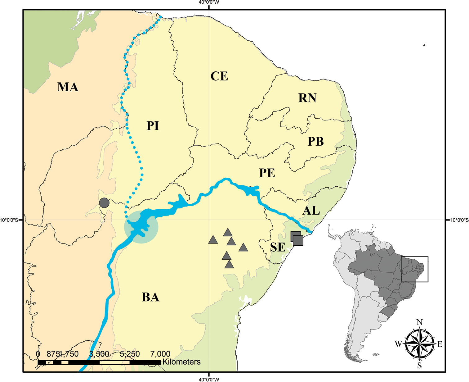
Figure 11. Distribution map of Mcvaughia: triangle – M.bahiana, circle – M.piauhiensis, and square – M.sergipana. Solid blue line in the center represents the São Francisco River today. Dotted blue line represents the past course of São Francisco River. Blue circle represents the São Francisco paleo lake. Light green – Atlantic Forest domain, dark green – Amazon Forest domain, orange – Cerrado domain, and yellow – Caatinga domain. AL – state of Alagoas, BA – state of Bahia, CE – state of Ceará, MA – state of Maranhão, PB – state of Paraíba, PE – state of Pernambuco, PI – state of Piauí, RN – state of Rio Grande do Norte, and SE – state of Sergipe.
Included On The Following Pages:
This image is not featured in any collections.
Source Information
- license
- cc-by-3.0
- copyright
- Rafael F. Almeida, Isabel R. Guesdon, Marcelo R. Pace, Renata M.S. Meira
- bibliographic citation
- Almeida R, Guesdon I, Pace M, Meira R (2019) Taxonomic revision of Mcvaughia W.R.Anderson (Malpighiaceae): notes on vegetative and reproductive anatomy and the description of a new species PhytoKeys (117): 45–72
- original
- original media file
- visit source
- partner site
- Phytokeys
- ID